tools to learn more about your site
One of the first things we do when start a new project is to obtain as much information as possible about the site ourselves. Below are a few places to start that you can do it yourselves too (that is free or cost very little)
VICPLAN (for zoning)
https://mapshare.vic.gov.au/vicplan/
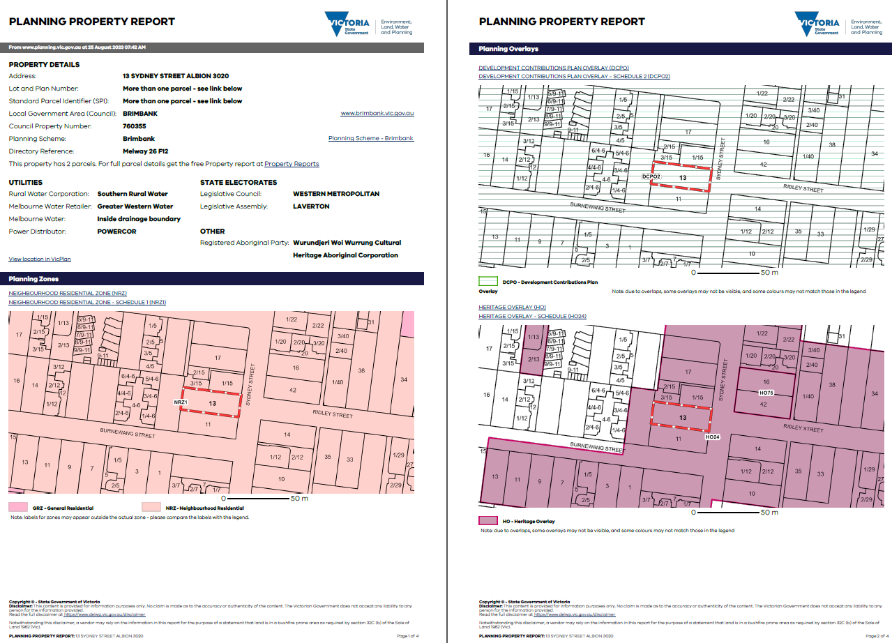
Vicplan is Victoria’s official planning zone and overlay information service. It allows you to find out relevant applicable planning rules to your site of interest; and generate a planning property report. Simply search for your address, and click ‘Create Planning Property Report’ to find our which zoning your property is in, and whether there’s any applicable overlay. If you click on the zoning/overlay link, it will take you straight to the relevant Council Planning Scheme with all the details on what you can/cannot do with your project. However it is quite technical and is mainly for the use of town planners / architects.
Below is a sample “Planning Property Report” which shows that the property is within a Neighbourhood Residential Zone - Schedule 1 (NRZ1) and has a Development Contributions Plan Overlay (DCPO2) & Heritage Overlay (HO24) on it.
LANDATA (for title information)
https://www.landata.online/
Landata can be used to obtain information including title search, survey, property sales, etc. Most relevant to your project are:
Easement: Easement is a right held by someone to use land belonging to someone else for a specific purpose. There are many type of easements which dictate the extent & construction method of your building. Some common easement are:
Drainage & sewer easement (right held by Council or water authority)
Right of Way easement allows the specified party to travel or pass through your land. (for example, a road or path through your land)
Covenant: This is a separate document (available via ‘instrument search’) which is a written agreement between the seller and purchaser restricting what the land can be used. Some examples are restriction on the external material (i.e brick), restriction on front fence (i.e no fence for the first 9m of the site) etc
Section 173: This is an agreement between the land owner and the responsible authority to set out conditions or restrictions on the use or development of the land.
It is often very complex if you want to amend these information about your property and you should seek advices from a town planner / land surveyor / solicitor.
BEFORE YOU DIG AUSTRALIA - BYDA (for underground assets)
Formerly known as Dial Before You Dig (DBYD), BYDA is a national organization that provides free pre-excavation referral service. This is useful to know the rough location of any underground sewer or drainage pipe within your land; as well as nearby gas/sewer/drainage assets. This might help you assess the level of difficulty to connect the services of your new extension to the existing.
PROPERTY INFORMATION REQUEST
This is a application form that you can lodge with your local Council’s Building Department to ascertain:
Any building approval / application in the past
Information regarding termites, land liable to flooding, etc
Legal point of discharge (a point where stormwater from a property must be discharge to)
If you’d like to discuss your project, please get in touch for an obligation free consultation - tran@tfarc.com

